Aiming for Zero Evacuation Delays via Flood Predictions and Evacuation Orders
May. 23, 2023
Hiroki Ikarashi
As heavy rains and floods caused by climate change are occurring in many parts of the world and causing enormous damage, flood control measures to reduce and prevent flood damage from both rivers and drainage area have become a pressing issue for national and local governments.
Against this backdrop, Hitachi, Ltd. conducted a study from June to September 2022 in conjunction with the Higashine city government in Yamagata Prefecture, northern Japan, which has experienced flood damage due to heavy rainfall, all so as to take advantage of flood predictions for evacuation orders, thereby confirming the effectiveness of their system. In this article, the people in charge of the project talk about how their aim is for zero delays in evacuating residents.
Flood hammering the village
The technical basis for this joint research is Hitachi Power Solutions' DioVISTA software, which has been in operation for about 15 years and has been used mainly for simulating flood damage in urban planning.
However, dramatic improvements in computer calculation speed and software feature enhancements in recent years have made it possible to incorporate rainfall and other information in real time. This has expanded the software’s range of applications.
Takashi Matsui of Hitachi, Ltd. who is leading the project, passionately states: "The evolution of DioVISTA has made it possible to predict what will happen with rivers and streams several hours into the future. We wanted to link this software to actual disaster prevention and management of river-related infrastructure facilities (such as dams, drainage pump stations, and sluice gates)."
Matsui has long been involved in the development and operation of disaster prevention systems for national and local governments and is an expert at handling disaster prevention information.
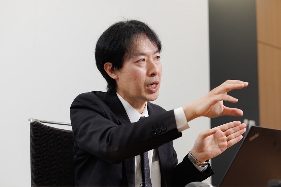
According to Matsui, the company began approaching municipalities across Japan two years ago with a view to using DioVISTA in the construction of disaster prevention and river-related infrastructure. The Higashine city government in Yamagata Prefecture, known for producing the most cherries in Japan, expressed their interest.
The city government also had a strong interest in real-time flood predictions. Mr. Kenichi Misaka of the Crisis Management Office at Higashine City Hall recalled the torrential rainfall that occurred in July 2020.
"The heavy rain that fell from July 27 to 29 of that year caused the Mogami River to overflow, flooding parts of Higashine City above floor level. Fortunately, no lives were lost, but neighboring cities, towns, and villages quickly issued evacuation orders, leaving some residents in Higashine to ask why their city had not been ordered to evacuate yet."
Evacuation orders are issued by each municipality in compliance with Japan’s Basic Act on Disaster Management and in line with its own rules and the judgment of the head of the municipality. Higashine City did not immediately issue an evacuation order because the water level of the Mogami River, which is a factor in making a decision, had not reached the standard for issuing such an order. Mr. Misaka regretfully said: "We had to clearly inform the citizens of Higashine City why the evacuation order was issued later than the surrounding municipalities."
Successfully predicting 97% of the flooded area
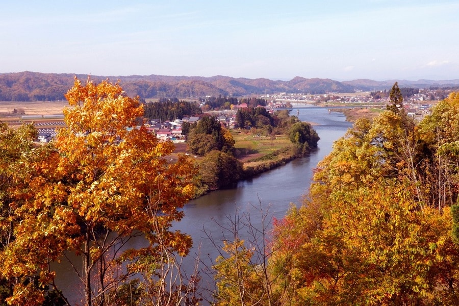
As the desire of Hitachi and the Higashine city government to predict flooding in real time and to apply the results to evacuation orders overlapped, they launched a joint research project.
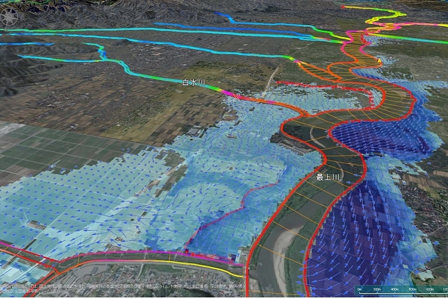
The research used data on rivers and water levels in the Mogami River drainage basin maintained by Japan’s Ministry of Land, Infrastructure, Transport and Tourism and the Yamagata prefectural government, as well as rainfall prediction data on the torrential rainfall that occurred in July 2020, to conduct a reproduction experiment to predict flooding at that time.
As a result, it was found that flooding in Higashine City could be predicted 1.5 days before occurring. Furthermore, when flood forecasting was conducted using data from 6 hours prior to the disaster, 97% of the area that was actually flooded was predicted to be flooded.
It was also found that, at the time of the disaster, the confluence of the Mogami River (main river) and the Shiromizu River (tributary) created a backwater effect whereby water flowed back into the tributary from the main river, causing the Shiromizu River to burst its banks and flood the area.
Such a detailed analysis was possible because the system integrated data from the main river and its tributaries, enabling an integrated simulation of the entire Mogami River basin.
Using flood predictions to help with evacuation orders
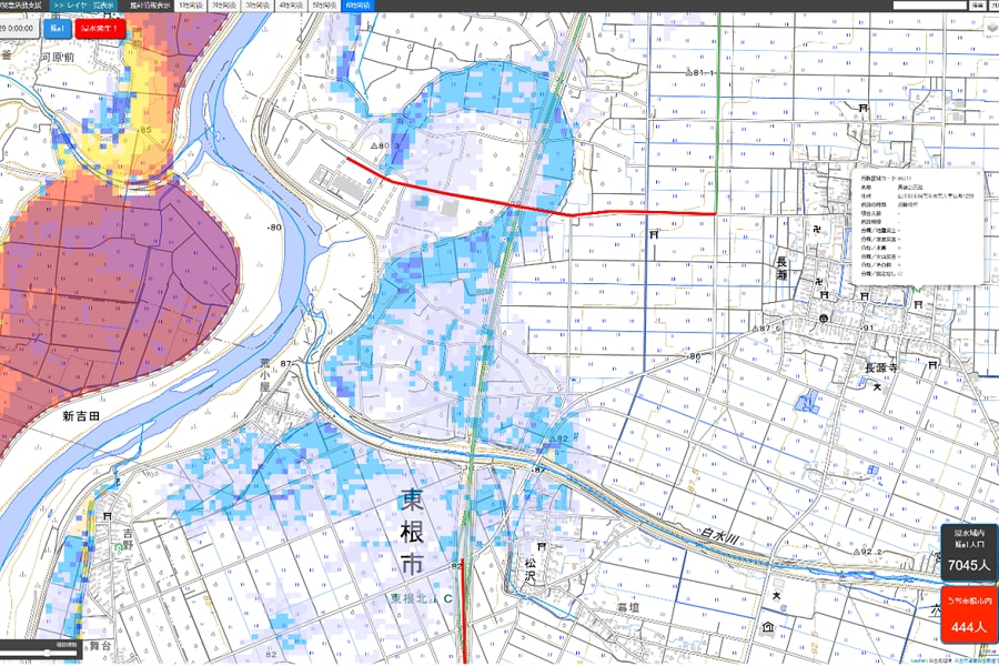
Furthermore, the project also developed and demonstrated the Flood Prevention and Mitigation System which leverages flood predictions to help local government officials in issuing evacuation orders and conducting emergency activities.
By linking DioVISTA with rainfall predictions, map information, river and water level data, and other data, the system estimates the number of residents affected by flooding, predicts the locations of roads where traffic will be restricted, and helps with issuing evacuation orders, opening evacuation centers, and other activities.
The joint research confirmed that the system is also effective in the event of a disaster. Mr. Misaka of the Higashine city government expressed his expectations for the system's use in the future:
"When the torrential rains hit in July 2020, there was all sorts of trouble when emergency vehicles could not pass through an expressway exit because it was flooded. However, if we had such simulations, we would have been able to respond flexibly by avoiding the flooded areas and getting off at the exits before the flooded areas. We felt that the simulation could be used to consider not only the timing of when to issue evacuation orders but also more-practical evacuation orders and disaster support."
Aiming for zero evacuation delays
Although the joint research was a success, Hitachi’s Matsui points out: "DioVISTA has its issues." For example, he says: "It would be difficult even if we had 100 years" to perfectly predict through simulations the locations where levees are likely to break or the occurrence of landslides. He continued:
"If we can quickly and precisely direct evacuation in terms of placing the highest priority on people, we can achieve zero evacuation delays. Furthermore, if disaster response organizations can share among themselves information on what equipment and supplies can be deployed and delivered and where, so as to maintain the quality of life for evacuees, it should be possible to prevent health problems at evacuation shelters. Moreover, if we can control river-related infrastructure such as dams, drainage pump stations, and sluice gates, we can contribute to the mitigation of flood damage itself."
Regarding Matsui's comment about "zero evacuation delays", Mr. Misaka of the Higashine city government expressed his hope for future development, saying: "It would be very helpful if information on people that need to be rescued could be immediately sent to rescuers, and rescuers could be informed of an appropriate route to get there."
Mr. Misaka then expressed his determination to continue working on disaster prevention activities:
"I would like to take advantage of the information obtained from this research to raise residents' awareness of disaster preparedness. We are already showing the simulation video to visitors at the Disaster Prevention Center, but we would like to consider more effective ways of presenting the data and images."


