Hitachi

Using Satellites to Measure Tree Height: Innovating Reforestation Industry

Aug. 20, 2020 Editing Team

The reforestation industry supplies products such as lumber and pulp, with pulp being the main raw material in toilet paper and other paper products essential to our daily lives. Against this backdrop, the reforestation industry is facing a number of challenges, such as how to expand production while protecting the environment and reducing labor-intensive work.

Hitachi and a major Japanese trading company, Marubeni, have been carrying out Proof of Concept aimed at solutions for such challenges. The site of their activities is the vast forestland on the island of Sumatra in Indonesia, an area about three hours by car from the nearest airport. A paved road starts the journey but changes to dirt for the rest until reaching the destination. The Proof of Concept conducted in such an adverse environment brought to light how the reforestation industry needs to adapt to a new age toward sustainability.

Background

Maximizing the potential of reforestation land

The site of demonstration testing conducted by Hitachi and Marubeni is a reforested area managed by PT. Musi Hutan Persada (MHP), a local affiliate wholly owned by Marubeni. Named “Musi Hutan Persada” (great forest in Musi) after the Musi River, a major river coursing through southern Sumatra, MHP is in charge of part of the paper pulp manufacturing business that Marubeni is deploying in Indonesia.

Marubeni's pulp manufacturing business prioritizes sustainability with respect to coexisting with the natural environment. One feature of their business is that it uses pulpwood logged from reforested areas instead of wood produced in natural forests as the raw material for pulp production. MHP supplies the needed pulpwood and delivers all pulpwood that it ships to pulp manufacturing plants run by a sister company of MHP. MHP manages a vast reforestation land of about 290,000 hectares, an area about 1.3 times the size of the wholeTokyo Area. Using a part of this land, Proof of Concept was carried out in two phases from September to October 2019.

Video: Reforestation land as captured by a drone

The purpose of this Proof of Concept was to verify technology for the high-efficiency, high-precision measurement of tree height using a satellite positioning technology, a task required to measure timber inventory. Timber inventory is the total volume of trees planted in a stand of a certain size and is basic information essential to managing the yield of reforestation land. The volume of a tree—the basis for timber inventory—is calculated from the cross-sectional area of the tree trunk and the tree height. If the technology targeted by Proof of Concept can be made practical, it will make it possible to efficiently measure timber inventory with increased precision.

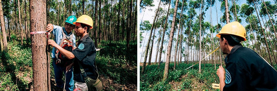
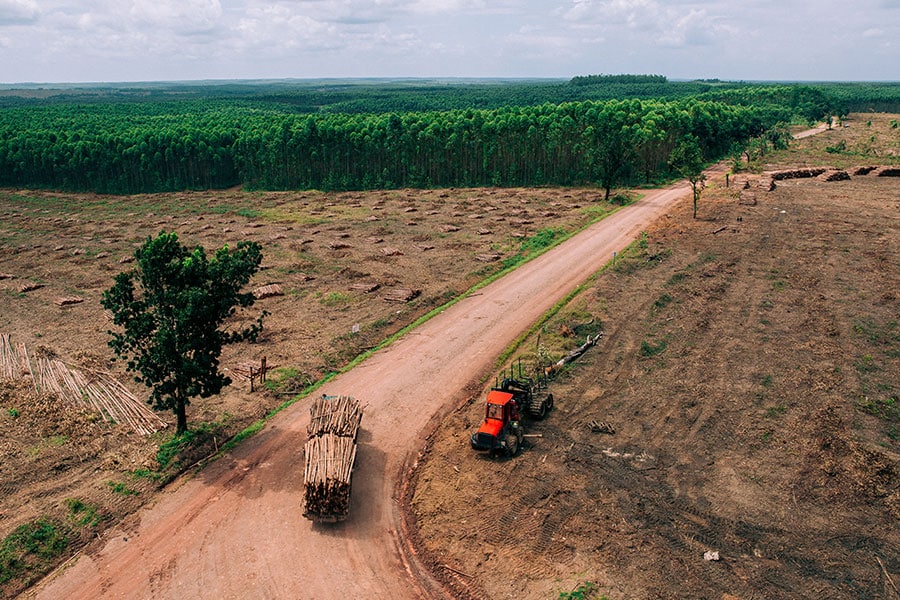
The reason why MHP is working on developing such technology is because minutely ascertaining the timber inventory of entire reforestation areas with high precision will make it possible to optimize a series of processes concerning reforestation and raise supply capacity.

This will allow the company to supply lumber to other fields besides paper pulp, such as biomass energy, in an effort to further expand its business. Regarding the reason why timber inventory measurement bears an important role, Mr. Takuya Kuwahara, a top executive at MHP at the time of the interview for this article, mentioned as follows:

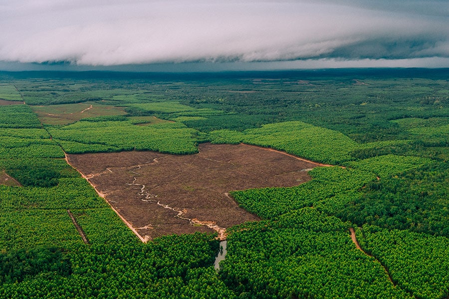
"Visualization and high precision are important in the improvement of reforestation business productivity. What I mean by this is to ascertain timber inventory in minute detail and raise precision even further. This brings into relief the challenges that must be addressed for improvement."

Mr. Takuya Kuwahara

Difficulty of manually gathering information from a vast area

However, there was a major challenge. Currently, timber inventory is measured manually. This is accomplished by workers entering a vast reforestation area and taking measurements, a process that requires considerable human and time resources. In addition, this process lacks the capacity to obtain information of satisfactory precision.

Workers manually measuring a tree

In the case of MHP, the area of land logged annually totals 20,000 hectares. No amount of time would allow for every single tree among the huge number growing there to be measured. A sampling method is therefore used: timber inventory for the entire area is estimated based on the results of timber inventory measurements for a partial area. Because this method obtains only an estimated timber inventory value, its accuracy is limited. Moreover, inconsistency in measurement results is difficult to avoid due to the reliance on the skill and experience of the people taking the measurements. And even with a workload that has been reduced by adopting a sampling method, it still takes about half a year to measure the timber inventory of 20,000 hectares using a team of 100 people.

Solution

Using satellites to instantly measure tree height

As a solution to this issue, Hitachi proposed the idea of using Japan's Quasi-Zenith Satellite System, also known as “Michibiki,” to instantly measure the height of a large number of trees all at one time.

In contrast to the positional information obtained by commercial vehicle GPS systems and smartphones, which has errors of several meters, the amount of error by Michibiki is only several centimeters. Hitachi saw this as a means of making it possible to efficiently measure tree height.

For several years, Hitachi has been working on pioneering Michibiki application fields. In one example, Hitachi developed a system for measuring such agricultural parameters as agricultural work status and crop growth, and also conducted demonstration testing for this in Australia from 2014 to 2018. The idea for a solution to MHP's challenge was an outgrowth of this experience.

The Quasi-Zenith Satellite System, also known as “Michibiki” Image courtesy of: Japan Aerospace Exploration Agency (JAXA)

Finding out the actual needs at on-site visits

Hitachi put together a project team comprising mainly of engineers that had been involved in the Australian Proof of Concept. By just four months later, this team had come up with a hypothesis for a solution. Next, project members visited the site to directly observe MHP's operations in order to obtain a concrete grasp of the associated needs. As a result of further discussions with MHP, the decision was made to develop technology for efficient tree height measurement based on the measurement technology developed in Australia.

Specifically, this meant a system that utilizes drones and tractors equipped to obtain high-precision positional information from Michibiki for tree height measurement. Drones flying over reforestation land are used to capture images of the areas to be measured. The positions of treetops are then initially calculated from this image data and drone positional information data.

It is then possible to calculate tree heights in areas targeted for measurement from the difference between the tree top data and elevation data obtained from tractors traveling on the ground. “GeoMation”, Hitachi's geographical information system, played a major part in this data processing series.

Schematic of a satellite-based system for measuring the height of massive numbers of trees

Collaborative Creation

Digital shift came out from understanding of on-site conditions

Hitachi members dispatched from Japan and MHP members that were involved in reforestation management and operations participated in this Proof of Concept. Hitachi provided equipment, such as receivers for acquiring data from Michibiki, and drones, while MHP members were mainly in charge of gathering data using drones and tractors equipped with the receivers.

Hitachi, with its various information and communication technologies (ICT), and MHP, with its extensive experience and expertise in reforestation management, teamed up to implement Proof of Concept that became an opportunity to take on the challenge of finding solutions as a collaborative creation project.

MHP's Mr. Albertus Handoko, who is a geographic information system (GIS) specialist and a participant in the project, commented as follows about the collaborative creation with Hitachi:

"I was able to gain a lot of new knowledge from Hitachi people through this project. As we progressed through the project, we came up against various challenges, but members from both companies worked as one to find solutions. I think it is this very frontline learning process that has value in driving the evolution of the reforestation business."

Mr. Albertus Handoko

Surmounting unexpectedly harsh conditions

The knowledge and expertise acquired on the frontlines become information that is indispensable in refining solutions to a level that would allow societal implementation. Proof of Concept did in fact encounter a variety of challenges.

One of these involved trouble with the Indonesian climate. Notebook computers brought from Japan to process data from satellite positional systems malfunctioned when put into full operation in temperatures higher than Japan's. Secondary batteries installed in drones that heated up while flying due to radiant heat draining power more quickly than expected. Although unrelated to the climate, equipment installed on tractors experienced breakdowns caused by larger than expected vibrations from the tractor. The actual operational situation was much harsher than Hitachi project members anticipated.

Logging truck carrying a load harvested from reforestation land

Located in an area that is three hours by car from the city, MHP's reforestation land has no nearby home improvement centers or convenience stores. Whenever a problem arose, members from both companies cooperated in sharing wisdom so as to come up with ways to use the resources at hand to repair broken equipment and otherwise find solutions to challenges as they proceeded with the Proof of Concept. This is how project members learned about on-site conditions. This, plus their development of an understanding of an environment that can only be replicated on site, was indispensable toward driving a digital shift. In this sense, the process of finding solutions to the numerous challenges as they came up during testing through the cooperation of all members was a meaningful one.

Pickup truck driving down a dirt road through a vast reforestation land

Prospects

Accelerating digital shift in the reforestation industry

At present, the solutions verified by Proof of Concept can be applied to just a very few of the challenges that MHP is dealing with. Going forward, Hitachi is committed to taking advantage of lessons learned on the ground to find new solutions that will lead to advances in a reforestation industry that uses digital technologies.

As Mr. Kuwahara observes: "The trend toward digitalization, that is, the so-called ‘Fourth Industrial Revolution,’ has also reached the reforestation industry. Opportunities will surely increase for this and for Hitachi's extensive portfolio of technologies to make a difference. It is my hope that it will serve in the development of a sustainable forestry industry."

Most Read

Share